Los clientes AgritecGeo serán asesorados y acompañados por personal altamente capacitado de DISAGRO con recomendaciones adecuadas sobre el manejo nutricional y sanitario de su finca.
Para conocer las características del entorno en el que crece el cultivo y el efecto de ese ambiente en su desarrollo y crecimiento, se requiere contar con sensores de alta tecnología en el suelo, en la planta y en el aire.
Nuestro clima inteligente proporciona información valiosa sobre diferentes propiedades de clima. Además, mediante el sistema de alertas configurado en AgritecGEO, recibirá información sobre cuando su cultivo se encuentra bajo condiciones de estrés.
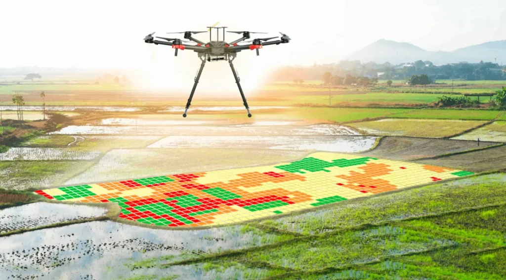
Es posible observar las propiedades fenologicas de cada planta en su cultivo, con una defición de hasta 3 centímetros, utilizando sensores de alta tecnología instalados en drones que sobrevuelan el cultivo y recopilan información con base en la reflectancia espectral de cada planta
El usuario recibirá alertas que le informarán anticipadamente sobre las condiciones climáticas que favorecerán la aparición de enfermedades foliares o del fruto.
Con base a la información de zonas de manejo homogéneo y los resultados de laboratorio AgritecGEO ofrece un portafolio de soluciones basados en productos de nutrición y protección desarrollados con la más alta tecnología y de forma específica para cada cultivo.
AgritecGEO comunica de forma constante información relevante a nivel mundial sobre temas relacionados como cotización de productos en bolsa, precios de insumos agrícolas y novedades agrícolas.
Para activar su cuenta necesitamos validar los siguientes datos:
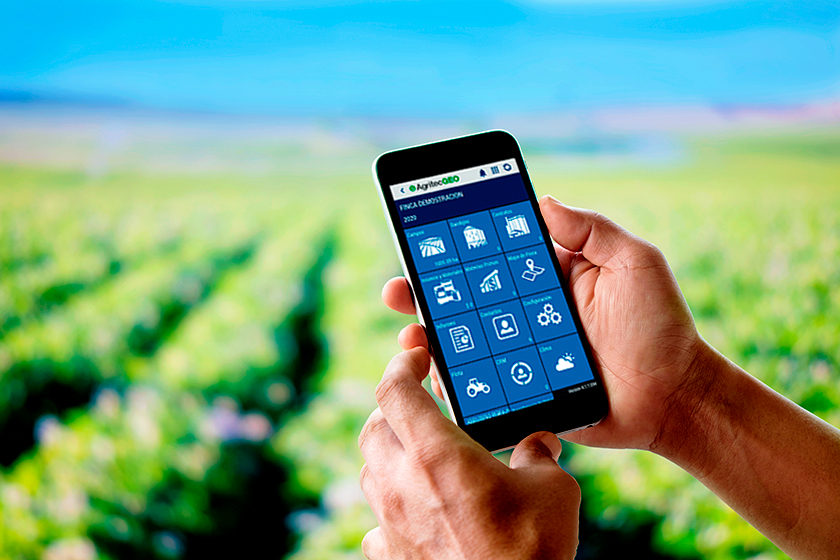
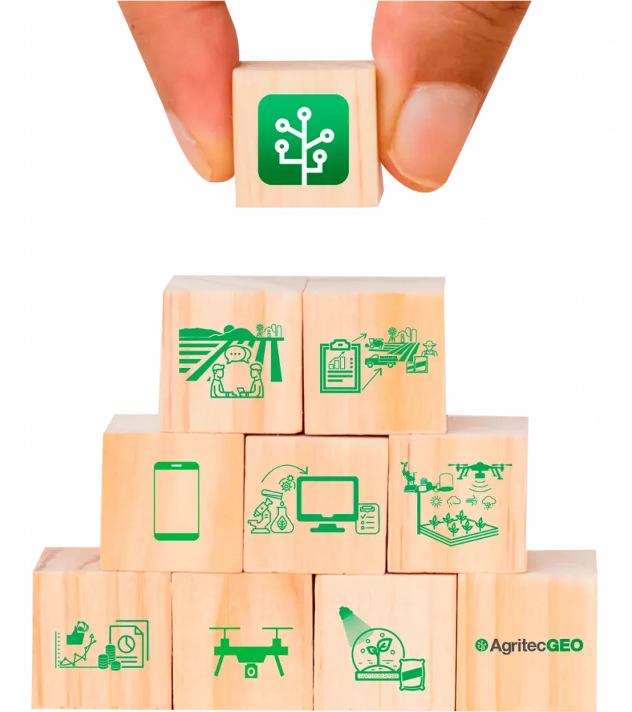
Software de
agricultura avanzada
El software de agricultura avanzada es una manera de comunicación ágil que ha diseñado DISAGRO para que sus clientes puedan visualizar todos los servicios de agricultura digital que de forma exclusiva ofrecemos en la región.
Asesoría agronómica
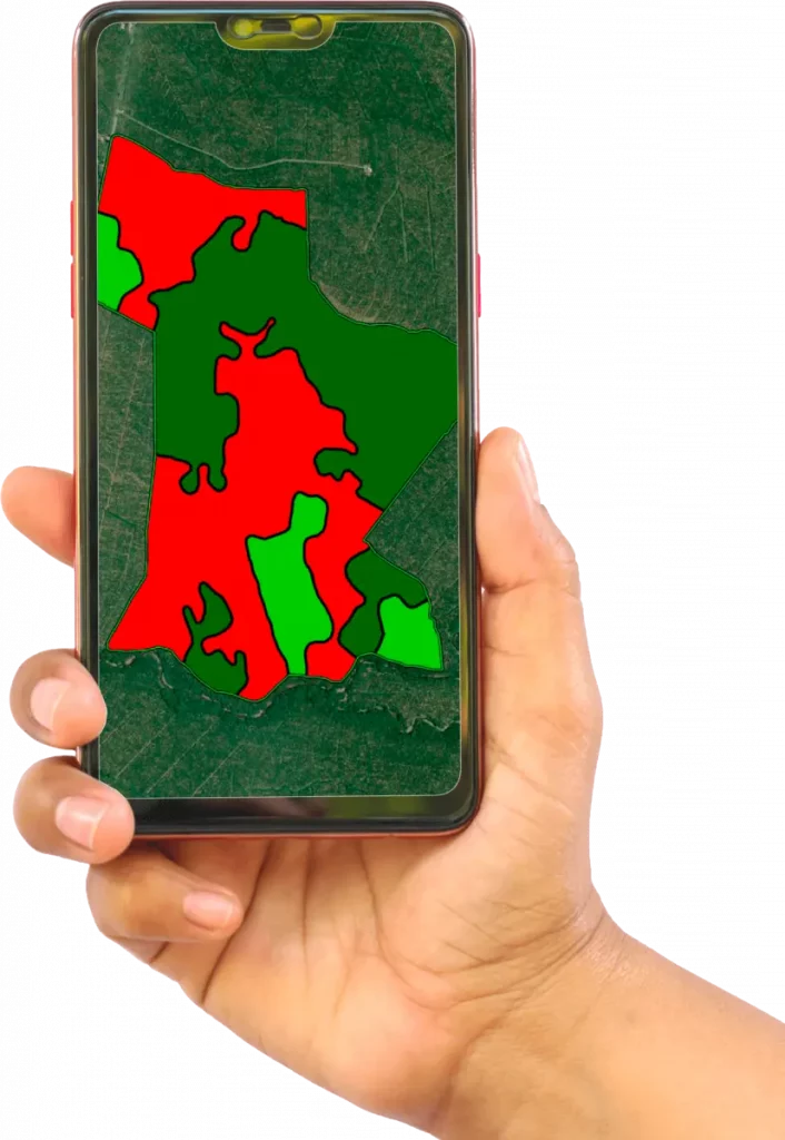
El punto de partida para una buena asesoría agronómica es la creación de zonas de manejo homogéneo. AgritecGEO cuantifica la variabilidad espacial del suelo mediante el muestreo de las propiedades físicas y químicas. Con base en las necesidades del cultivo y la disponibilidad de nutrientes en estas zonas se realizan las recomendaciones precisas de insumos agrícolas.
En AgritecGEO existen tres maneras de realizar la división de zonas homogéneas de manejo:
Power zones Se generan índices de vegetación que identifican el comportamiento foliar del cultivo durante los últimos años, basándose en imágenes de satélite históricas y agrupando las áreas que a lo largo de este período expresen vigor y salud muy similares.
Física de suelos Con base en un diseño idóneo para el cultivo y la topología del terreno se realizan muestreos de suelo y se analiza pH, conductividad eléctrica, textura, densidad compactación y porosidad.
Fertilidad de suelos Se diseña un muestreo de suelos específico para el cultivo o terreno donde se analizan macro y micronutrientes, así como capacidad de intercambio catiónico. Con base en esta zonificación se determina la ubicación idónea de sensores, la frecuencia y la dosis de las prácticas de manejo como riego, protección y nutrición de cultivos.
Análisis y diagnóstico
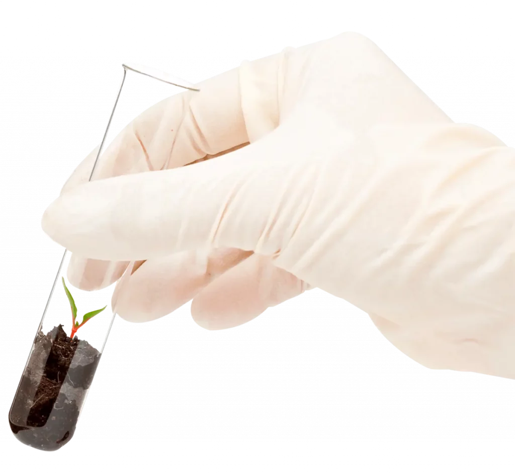
Análisis de suelos Esta metodología brinda una visión de la variabilidad espacial de los diferentes macro y micronutrientes en el suelo y su disponibilidad para la planta. Es una herramienta básica requerida para el diseño de programas de nutrición óptimos para todos los cultivos. La realización rutinaria de estos análisis permite entender el efecto de las prácticas de fertilización, riego y preparación en la fertilidad del suelo.
Análisis foliar Determina el contenido de macro y micronutrientes es parte de la planta muestreada, que comúnmente es la hoja. La correcta interpretación del análisis foliar es utilizada para estimar el estado nutricional de la planta e indirectamente estimar la capacidad del suelo de suministrar nutrientes al cultivo. Este análisis, asume que el tejido muestreado refleja la acumulación de nutrientes en toda la planta entera y en las demás plantas del cultivo. Es por ello, que la calidad del muestreo es el factor más determinante en la representatividad de los resultados obtenidos.
Análisis de fruto Está diseñado para determinar la composición nutricional y el contenido total de elementos minerales en el fruto. Con esta metodología se logra diferenciar los minerales fisiológicamente activos dentro del fruto como calcio y potasio, además de cuantificar propiedades relacionadas con el sabor. Estos parámetros se integran para determinar la calidad de la fruta, el momento óptimo de cosecha, la vida en poscosecha y las características de almacenamiento.
Análisis de solución de suelos Para entender cuanto del fertilizante aplicado y del suplemento nativo de nutrientes está disponible para ser absorbido por el cultivo, el personal técnico de AgritecGEO instala sondas de succión a diferentes profundidades, que simulan raíces y recolectan muestras de solución del suelo; en las cuales mediante procesos analíticos de laboratorio es determinada la concentración de nutrientes.
Análisis de agua de riego Es una analítica fundamental para estimar las propiedades físico-químicas del agua de riego y el aporte de nutrientes. Con esta información es posible diseñar las disoluciones de fertilizantes, en el caso que se realice ferti-riego. Además, este análisis provee información sobre el carácter salino del agua de riego y de esta forma poder estimar su efecto en el pH y la salinidad del suelo en donde es aplicada.
Sensores de proximidad
Sensores de humedad: Mediante la adopción de este tipo de sensores es posible estimar el contenido volumétrico de humedad en el suelo cada 10 centímetros hasta una profundidad de 60 centímetros, cada 15 minutos. Reconocer si la lluvia o el agua de riego se está infiltrando en la zona de raíces del cultivo y de esta forma decidir el momento más oportuno para la aplicación de fertilizantes edáficos.
Con el sistema de alertas configurado en AgritecGEO es posible automatizar los tiempos y caudales de riego.
Sensores de conductividad o salinidad: Estos sensores permiten estimar el contenido total de sales en la solución del suelo en rangos de 10 centímetros hasta una profundidad máxima de 60 centímetros cada 15 minutos. El conocimiento de la concentración de sales solubles permite conocer si los fertilizantes aplicados se han solubilizado y están disponibles para ser absorbidos por el cultivo. Reconocer perfiles de agotamiento o de acumulación de sales, presumiendo problemas relacionados con la física de suelos como son: baja porosidad, limitada conductividad hídrica y capas compactadas.
Sensores de clorofila: el contenido de clorofila en las plantas está correlacionado positivamente con el índice de verdor del cultivo y el contenido de nitrógeno de las plantas y en consecuencia su actividad fotosintética.
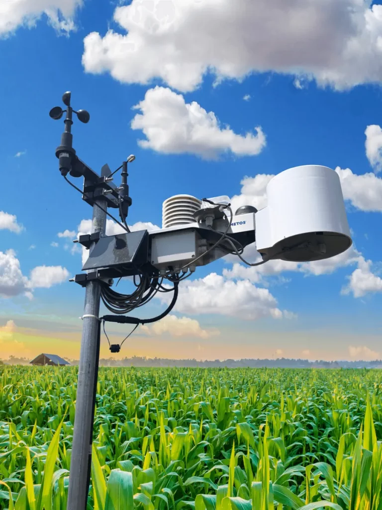
Clima inteligente
Las estaciones meteorológicas brindadas por AgritecGEO proporcionan un servicio denominado clima inteligente, el cual ofrece información sobre diferentes propiedades de clima como son: intensidad y frecuencia de lluvias, temperatura del aire, humedad relativa, velocidad y dirección del viento, brillo solar y humedad de la hoja.
El servicio de clima inteligente proporciona pronóstico de clima para lluvia, temperatura del aire, velocidad y dirección del viento, altura de la nubosidad y evaporación potencial.
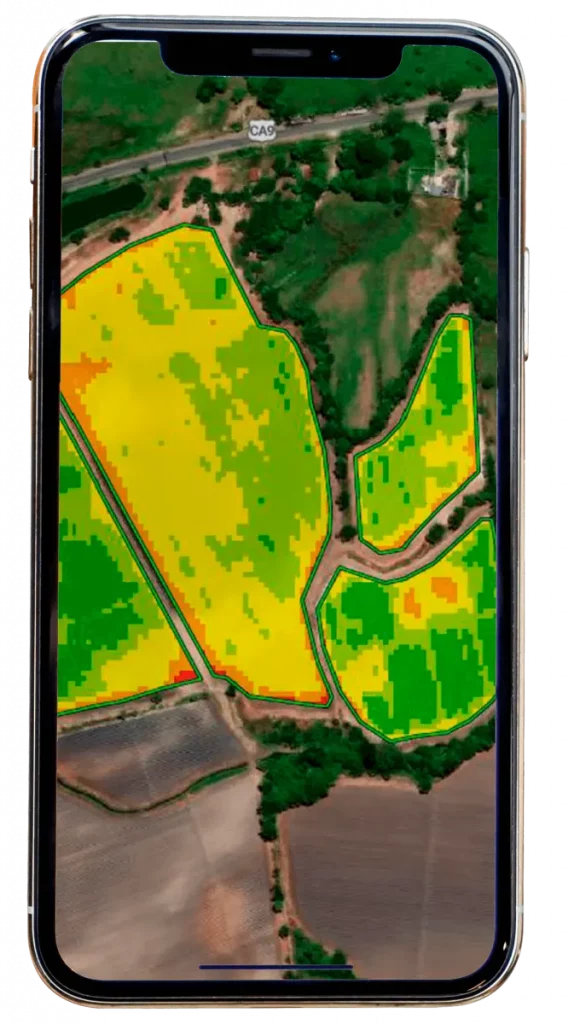
Imágenes satelitales
Las imágenes satelitales permiten realizar un monitoreo digital a grandes extensiones de cultivo, con una muy buena resolución y con alta periodicidad.
Las imágenes pueden identificar en el cultivo áreas estresadas por ataque de plagas, enfermedades o malezas, zonas con deficiencias nutricionales o hídricas.
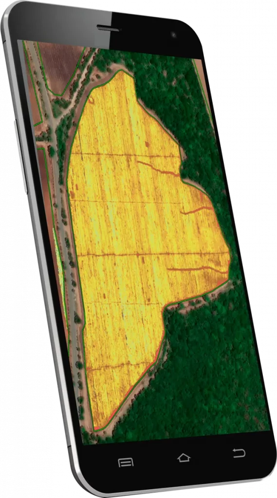
Imágenes en
alta resolución
Utilizando estas imágenes es posible identificar plantas enfermas o con deficiencias nutricionales (especialmente nitrógeno y azufre); además crear mapas de población o densidad, mapas de índice de estrés, actividad fotosintética y de diferentes índices de vegetación que se adaptan de acuerdo a la etapa de crecimiento del cultivo o a las necesidades del agricultor.
La adopción de este servicio permite hacer un diagnóstico de todas y cada una de las plantas de su cultivo, esto con la finalidad de realizar prácticas diferenciadas a las áreas que así lo requieran.
Modelos de pronóstico
El modelo de clima inteligente ofrecido por AgritecGEO, permite estimar la probabilidad de incidencia de enfermedades foliares. Envía alertas que informan los períodos en los que las condiciones climáticas favorecen la infección.
AgritecGEO cuenta con 85 modelos de incidencia de enfermedades de importancia económica en cuarenta cultivos. Estos modelos pueden ser activados exclusivamente cuando el servicio de clima inteligente ha sido contratado
Soluciones a la
medida del cultivo
Con base a la información de zonas de manejo homogéneo y los resultados de laboratorio AgritecGEO ofrece un portafolio de soluciones basados en productos de nutrición y protección desarrollados con la más alta tecnología y de forma específica para cada cultivo.
Información
de mercado
AgritecGEO proporciona información de interés sobre la comercialización de productos, información actualizada acerca de enfermedades, nuevas tendencias y las mejores prácticas relacionadas al cultivo. Esta información le ayudará a decidir cómo y cuándo sembrar, adoptar nuevas prácticas y anticiparse a nuevas exigencias del mercado internacional.